
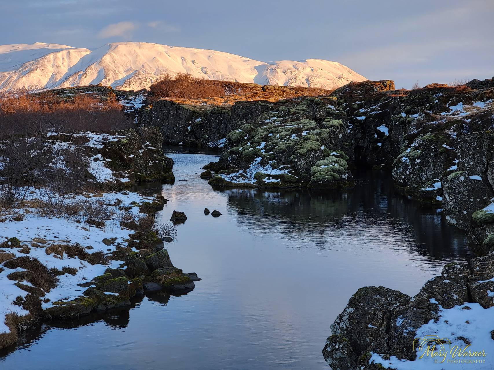
In South Iceland we visited Thingvellir National Park, which is both historically significant as well as being a geological wonder and is a UNESCO World Heritage Site. The Park’s unique geology comes from its location between the North American and Eurasian tectonic plates which creates the rift valley that runs through Iceland. Iceland is the only country where this valley, the Mid-Atlantic Ridge, can be seen above sea level and it is most visible in Thingvellir National Park. One of the popular activities in the Park is donning wetsuits and actually swimming in the rift. We were too busy taking pictures to attempt that particular activity. Historically speaking, the Vikings chose this location for the world’s oldest parliament, Althingi, when they first arrived in Iceland in the tenth century.
Click images to see larger slideshow.


As we traveled east on Iceland’s Ring Road, we came across many spectacular landscapes, including the Hekla volcano, which is one of Iceland’s most active volcanoes, with a height of 4,892 feet. It has erupted over 20 times since 874, with the most recent eruption on February 26, 2000. When not erupting, Hekla is often covered with snow and small glaciers and it normally only begins seismic activity 30-80 minutes before eruption.


The 200-foot Seljalandsfoss waterfall is right off the Ring Road on the South Coast of Iceland just a short walk from the parking lot. While it is possible to walk behind the waterfall, it was not considered safe when we were there due to snow and icy rocks.

Dyrhólaey translates to “door hole island,” and is believed to refer to the natural arch that serves as a “doorway” to the sea. It is of volcanic origin and was once an island before becoming attached to the Icelandic mainland. The arch was formed over time by wave erosion. On top of the headland stands an old square-towered white lighthouse completed in 1927 and still operational today. To the north are expansive views of black sand beaches and to the northeast are distant mountains. To the south, the sea-stacks of Reynisdrangar jut up from the sea. Before moving farther east, we stopped for lunch in the town of Vik and photographed the cute red-roofed Vik church.


Visit my Iceland Photo Galleries for additional photos of Iceland. Or watch my video on YouTube about the trip by clicking the arrow button below.
